
Latest Tech News

NCG Symposium 2018
What: NCG symposium 2018 Where: Wageningen, Netherlands When: 29 November 2018 Who: Claudia Stöcker and Sophie Crommelinck, University of Twente/ITC, Netherlands Why: Presentations by both PhD students about their its4land work What can UAVs do in 10 years? Maybe, they can transport people but to securely drop the passenger on the surface UAVs require a real-time precise [...]

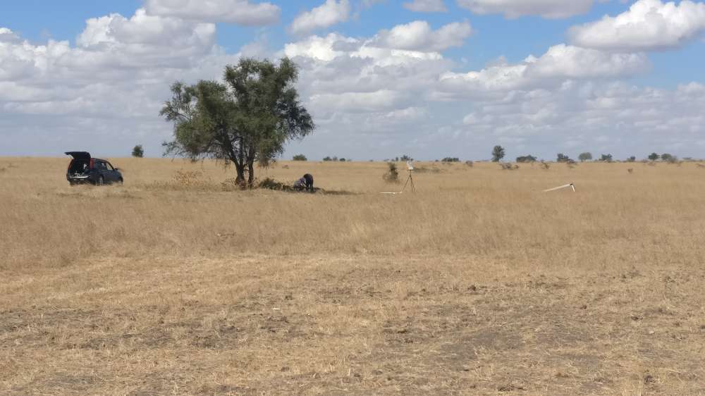
Fieldwork in Kajiado to test boundary delineation software
What: Fieldwork in Kajiado, Kenya When: 26-27 September 2018 Who: Sophie Crommelinck, University of Twente/Faculty of Geo-information Science and Earth Observation (ITC), Netherlands Purpose: To collect images, information and locations of cadastral boundaries and to get insights into current land mapping procedures and land-related challenges Setup: Together with a PhD candidate from the Technical University of [...]
Special issue “Remote Sensing for Land Administration” – call for papers
Mila Koeva and Rohan Bennett as two of the guest editors are glad to invite you to submit papers that adress the following topics: Comparisons of alternate remote sensing techniques for 2D and 3D data capture relevant to land administration and cadastres (including UAV imagery, VHRSI, RADAR, LiDAR, and multi-spectral approaches) Design and testing of [...]

its4land – Period 2 – European Commission Review
What: its4land – Period 2 – European Commission Review Where: Brussels, Belgium When: 16 October 2018 Who: EC Review Panel: F. Boissière, J. Santos with external reviewers K. Meuleman, D. Sladic and J. Kiema (not present), and the its4land team Why: A one day review corresponding to the second reporting period took place on Tuesday, 16 October 2018 at the European Commission [...]
Review of governance and capacity development models for its4land tools
The second deliverable of its4land’s Govern and Grow work package ‘Review of governance and capacity development models’ aims to get a better interdisciplinary understanding of existing models of governance and capacity development. Based on a literature review and the recommendations from the requirements synthesis done in the Get Needs work package (Deliverable 2.5), we’ve selected [...]
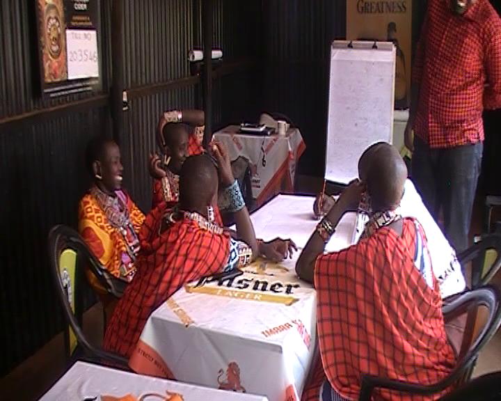
Interviews in Rwanda and Kenya to better understand the land tenure recording governance
What: Qualitative data collection in Rwanda and Kenya to understand the governance of the current land tenure recording situation and to find out how the its4land tools need to be used in a sustainable way. Where: Musanze and Kigali in Rwanda & Kajiado and Nairobi in Kenya Who: Rwanda: INES Ruhengeri and Esri Rwanda (Rwanda) [...]

Milestone in development of smart sketch maps system
Its4land researchers from the Institute for Geoinformatics at the University of Muenster submited three deliverables on 31st July this year. The three deliverables D3.3 qualitative representation of sketch maps; D3.4 documentation of extended LADM; and D3.5 prototype for sketch map alignment are all part of the Smart Sketch Maps system (a.k.a. Smart SkeMa) being developed under Work Package 3 of its4land. All [...]
Symposium on Feature Extraction for Cadastral Boundaries
What: Symposium on Feature Extraction for Cadastral Boundaries Where: University of Twente, Faculty of Geo-information Science and Earth Observation (ITC) When: 25 October 2018 Joined event between ITC and Kadastre International - exchange of experience in automatisation on feature extraction from imagery. Mila Koeva presented its4land and Sophie Crommelinck demonstrated the developed open source its4land tool.

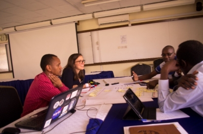
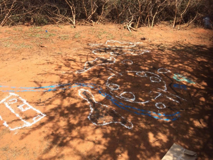
Workshops for feedback on its4land’s Smart Skema system
What: Field work in Kenya to demonstrate the functionality of the Smart Skema system in order to receive feedback on how the system could be used in actual practice Where: Kajiado and Nairobi, Kenya When: 24 September - 2 October 2018 Who: Malumbo Chipofya and Sahib Jan, researchers from Institut für Geoinformatik (WWU), Münster, Germany. Community [...]
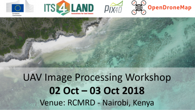
Capacity development – image processing workshop for its4land UAV pilots
What: Capacity development – image processing workshop for its4land UAV pilots Where: Regional Centre for Mapping of Ressources for Development (RCMRD), Nairobi, Kenya When: 2 and 3 October 2018 Who: Lead: University of Twente, Faculty of ITC (UT/ITC, Netherlands), Participants: Technical University of Kenya (TUK), Institut d’Enseignement Supérieur de Ruhengeri (INES, Rwanda), ESRI Rwanda, Bahir Dar [...]
Recent Comments