
Who are we linking with?
Building On Existing Initiatives
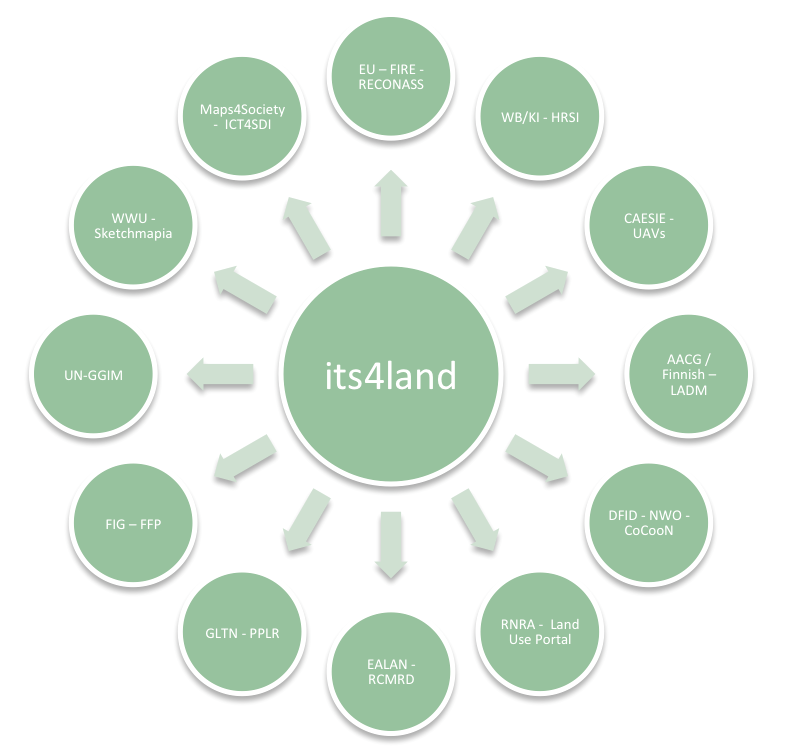
In Ethiopia, HL developed the urban land information system for Addis Ababa, and will very soon commence work on developing the rural land information system. The systems are based on the ISO LADM (Land Administration Domain Model) standard: the same standard to be used in several work packages within the project. Knowledge and lessons will be shared between the projects. BDU’s involvement in the Agricultural Growth Program (AGP) will be leveraged off in the identification of pilot areas and inclusion of beneficiary groups. From collaboration with Kadaster International (NL) and the World Bank, UT also brings experiences from field tests involving the use of high resolution satellite imagery for smallholder parcel mapping. In Kenya, both TUK’s and UT’s ongoing work and expertise, focused on pastoralist land mapping, provides the basis for the innovative work proposed here: the existing network of public sector actors, NGOs, and private sector players can be immediately leveraged off in the project. In this regard, UT’s recent workshop, financially supported by the Dutch Scientific Research Program (NWO) and DFID (UK), via the CoCooN program, provides a strong platform. In Rwanda, UT/ITC has several ongoing projects that provide input: this includes utilizing results from recent CAESIE grant work (http://caesie.org/), backed by the Australian Government and EC, and other UAV demonstrations, and collaborative research projects completed by the staff of INES and the Rwandan Natural Resource Agency (RNRA). ESRI Rwanda is closely linked with ICT development in the land sector in Rwanda: it recently completed the land use portal for RNRA, and this expertise can be utilized in design and scaling activities, particularly with regard to the geocloud services components of the work.
Creating Partnerships with Eastern Africa
The project links with a number of ongoing innovation activities in Ethiopia, Kenya, Rwanda, East Africa more generally, Europe, and internationally. At regional and international levels, the project will leverage off existing networks, including the East Africa Land Administration Network (EALAN) and Regional Centre for Mapping Resource for Development (RCMRD), for expertise, knowledge, and data. Academic partners from Ethiopia, Kenya, and Rwanda are members of EALAN: INES is secretariat. TUK plays an active role with RCMRD: base data for base maps and pilot investigations will be more easily acquired. The work is directly relevant to the African Union’s (AU) Land Policy Initiative: it will provide a means for implementation of several aspects of the document. In this regard, the project will have implementation support at higher levels of multiple governments. UT’s membership in the Global Land Tool Network (GLTN), coordinated by UN-Habitat, will be used to gain access to existing innovations in land tool development, but, will also greatly assist in dissemination activities via shared workshops and promoted publications. The heavy involvement of UT and TUK in the International Federation of Surveyor’s work on Fit-for-Purpose land administration initiatives provides a solid conceptual and theoretical basis for commencing the work. Moreover, like GLTN, it provides another vehicle for results dissemination – and opportunities for further scaling and piloting once the project finishes. The newly established UN initiative, UN-GGIM, including African coverage, and its listed goals in its 5-10 work plan report, also provides validation for the significance of the work.
Collaborating with Europe
Regarding linkages with ongoing projects based in the EU, the theoretical underpinnings and subsequent work packages are innovative continuations of work already engaged upon by consortium members. UT is engaged in two EU FP7 projects work on the use of UAVs for disaster mapping (RECONASS and INACHUS), the results clearly feed into designs and workflows that will be developed in this project. UT also maintains ongoing work into automatic feature extraction. In the mentioned FP7 projects there is a large automation component (fully automatic damage mapping). In addition, in 2015 collaboration took place between UT and Kadaster International in this regard (feature extraction for boundary mapping). The different cases of interest (Mozambique and Bangladesh) will provide alternative examinations of the potential utility of the approach. Meanwhile, KUL’s highly successful ‘Spatialist’ program, funded by the Flemish Agency for Innovation by Science and Technology, delivers the underpinnings and key learnings needed to successfully conduct the needs assessment and governance model development. KUL is also a leader in spatial data infrastructure development in Europe: it acts as secretariat of EuroSDR, meaning networks and knowledge repositories from across Europe can be exploited for design, testing and dissemination work. KUL, via the ICT4SDI project, funded by Netherlands Maps4Society scientific research program, can bring developed methodologies to support the development of the governance model. WWU’s project ‘SketchMapia’, funded by the German science foundation, DFG, forms the basis for the work package based on smart sketchmaps for land administration purposes: this new application builds from expertise developed in the previous project.
Linking with Commercial Partners
Industrial and commercial involvement is primarily provided via the two commercial partners: HL and ESRI. Both organizational memories are cognizant of exploitation pathways with regards to ICT dissemination in East Africa: tailored approaches to different sectors and users groups are usually a necessity. Importantly, both partners are innovators in the sense of adapting R&D developed in academia and private sector, for specific application in the domain of land tenure recording, and natural resource management more generally. Therefore, both play a role in phase 1 (contextualize) and gradually increase involvement as its4land progresses via the design work packages and finally to business model design in WP8. These commercial partners are well placed to disseminate and commercialize the tools in the case country, but, also East Africa and sub Saharan Africa more generally: both maintain business networks across the region. This includes awareness raising activities, advocacy work via high level interactions with government and international organizations, and also product demonstration and marketing.
Other Technology Affiliations
Involvement of other countries is foreseen in the context of subcontracting. Specifically, parts of WP4 (T4.2) and WP6 (T6.1; T6.5) party external to the consortium. All legal means will be used to ensure the arrangement is appropriately established. The SME will bring unique on-the-ground expertise in UAV operations for land tenure recording in East Africa and will bring previous collaborative experience, directly relating to UAV use and application. Inclusion of the SME is a logical and essential extension of the existing collaborations, and further extends the international reach and potential impact of the work: apart from introductory work by Micro Aerial Surveys (with whom UT has collaborative previously), very limited application of UAVs for land tenure recording in the East African context has been undertaken by other private sector entities. We are also working closely with technology suppliers Pix4D and Delair Tech for software and hardware relating to UAVs and image processing.
Recent Comments