
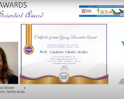
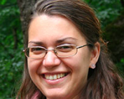
its4land’s PhD wins award
What: its4land PhD Claudia Stocker from University of Twente/ITC wins the young researcher award from the International Sustainable Aviation and Energy Research Society - SARES Where: Online at the SARES 2020 Award Ceremony, International Symposium [...]
its4land video: project in a nutshell
The its4land project has come to an end on 31 January 2020. We produced a short video that recaps the project in a nutshell. Enjoy!
its4land – Period 3 – European Commission Review
What: its4land - Period 3 - European Commission Review Where: Brussels, Belgium When: 27 January 2020 Who: EC Review Panel, Jorge Santos, its4land MT (and 2 external independent experts) Why: A one day review corresponding to the third and final [...]
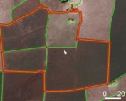
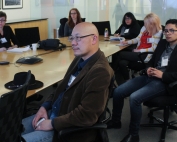
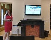
its4land Land Administration Toolbox launched at AfricaGIS
AfricaGIS is the largest geospatial, science and technology conference on the African Continent. The conference is held every two years and is organised by EIS-Africa, a pan African non-profit organisation. The AfricaGIS conference and exhibition [...]
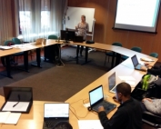
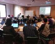
Annual NCG Symposium
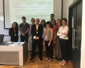
What: Annual NCG Symposium Where: ITC, Enschede, Netherlands When: Thursday, 21 November 2019 Who: Mila Koeva, its4land project coordinator, gave a presentation Why: The NCG Symposium is for all researchers and students of Dutch universities, academies and institutes that [...]
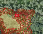
Cadastral mapping faster and cheaper thanks to automation
Cadastral mapping can be a lot cheaper and faster thanks to a 'smart' interactive computer program developed by UT PhD student Sophie Crommelinck. Read more about her research on the UT website. Sophie had her [...]
Intergeo 2019
Intergeo is the largest platform of the geopatial community worldwide. This year the conference celebrated its 25th anniversary and took place in Stuttgart, Germany, from 17 – 19 September 2019. The conference hosted more than [...]
CALL FOR PAPERS – for special issue ‘Remote Sensing for Land Administration’
CALL FOR PAPERS - Special issue “Remote Sensing for Land Administration” The deadline for paper submission was extended to 16 December 2019. Mila Koeva and Rohan Bennett as two of the guest editors are glad [...]
EALAN conference, Zanzibar
What: its4land presentations at EALAN AGM and conference 2019 Where: Zanzibar, Tanzania When: 16-26 July 2019 Who: Sophie Crommelinck, Claudia Stöcker (University of Twente/ITC, Netherlands) The EALAN conference was a 1.5 days conference with about 110 participants, mainly [...]
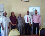
Strengthening strategic collaborations of its4land in Zanzibar
What: Strengthening strategic collaborations of its4land in Zanzibar Where: Stone Town, State University of Zanzibar When: 23 July 2019 Who: Claudia Stöcker, University of Twente/ITC, Netherlands Why: Zanzibar is a potential case location to continue [...]
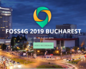
FOSS4G 2019
What: its4land presentation at FOSS4G conference 2019 Where: Bucharest, Romania When: 26-30 August 2019 Who: Ivan Ivanov (University of Twente/ITC, Netherlands) The annual worldwide FOSS4G conference took place in Bucharest, where the its4land project was presented. A key [...]
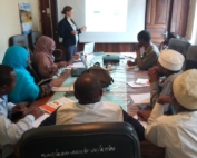
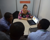
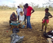
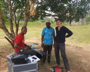
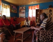
Data collection in Zanzibar
What: Data collection in Zanzibar Where: Stone Town, Commission of Lands Zanzibar When: 19 July 2019 Who: Claudia Stöcker, University of Twente/ITC, Netherlands Why: Work package 4, which is about UAV-based data acquisition for land [...]
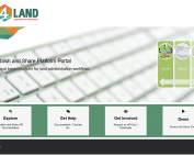
its4land Publish and Share platform ready for testing
The Hansa Luftbild team has now released the Publish and Share platform for internal and external tests and evaluations. We have developed the main technical components of Publish and Share to Technology Readiness Level (TRL) [...]
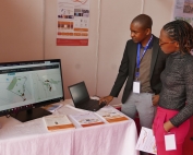
its4land at RCMRD International Conference & 4th AfriGEO Symposium
What: its4land presentations and exhibition at RCMRD International Conference & 4th AfriGEOSS Symposium Where: Nairobi, Kenya When: 13-14 August 2019 Who: Sophie Crommelinck, (University of Twente/ITC, Netherlands), Malumbo Chipofya (University of Muenster, Germany), Tarek Zein (Hansa Luftbild, Germany), Kaspar [...]
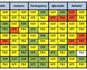
Assessing compatibility of a country’s Governance and Capacity with the its4land land administration toolbox using the newly developed its4land scorecard
its4land’s work package 7 (WP7) – ‘Govern and Grow: Sustainable governance and capacity building’ recently delivered its 4th deliverable (D7.4). WP7 deals specifically with the development of a governance and capacity development model to support [...]
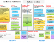
Business model for its4land tools ready
Work Package 8 (WP8) titled Capitalize has reached a major achievement with the project deliverable 8.1 being submitted and released. This deliverable covers the design of the appropriate business model and the definition of the [...]
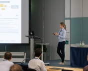
its4land toolbox launch event at ISPRS Geospatial Week 2019
What: ISPRS Geospatial Week 2019 Where: Enschede, The Netherlands When: 10-14 June 2019 Who: Malumbo Chipofya, Sahib Jan, Angela Schwering (University of Münster, Germany), Tarek Zein, Christian Timm (Hansa Luftbild, Germany), Kaspar Kundert (ESRI, Rwanda), Joep Crompvoets [...]
4th Annual Land Conference Bahir Dar Ethiopia
What: 4th Annual Land Conference of the Institute of Land Administration at the Bahir Dar University Where: Bahir Dar University, Ethiopia When: 24-25 May 2019 Who: Tarek Zein (Hansa Luftbild, Germany) Output: On 24 and 25 May the [...]
New its4land ISI publication about UAS
What: its4land scientific publications about the match between the use of Unmanned Aerial Systems and the needs of communities and governments in the land sector in Rwanda. Where: MDPI – Remote Sensing journal When: 1 [...]
Concept of Extended LADM Ontology
The SmartSkeMa team at IfGI (University of Muenster) successfully submitted their sixth project deliverable, D3.6, titled Concept of extended LADM ontology. The deliverable report outlines how its4land’s SmartSkeMa system addresses the mismatch between informal, indigenous, [...]
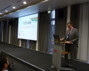
Geospatial World Forum
What: Geospatial World Forum 2019 Geospatial World Forum is a collaborative and interactive platform, which demonstrates collective and shared vision of the global geospatial community. It is an annual gathering of geospatial professionals and leaders [...]
World Bank conference 2019
What: Land and Poverty Conference 2019: Catalyzing Innovation Where: Washington DC, United States When: 25-29 March 2019 Who: its4land gave a 90-minutes masterclass on Friday 29 March as well as three presentations. Output: Find below the programme of the [...]
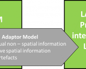
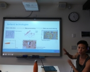
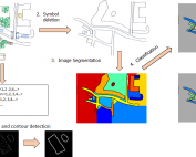
Sketch mapping still smarter with new interface
Early this year, the SmartSkeMa team at IfGI (University of Muenster) introduced an update on their web-based user interface (UI) to the SmartSkeMa system (see Figure 1). This interface integrates all the components of SmartSkeMa. [...]
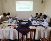
Capacity building in Rwanda – UAV image processing workshop for RLMUA
Where: Kigali, Rwanda When: 13 February 2019 What: As agreed between Rwanda Land Management and Use Authority (RLMUA) and the University of Twente, Faculty of Geo-information Science and Earth Observation (ITC), one part of the [...]
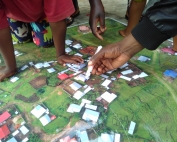
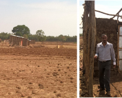
Participatory mapping of cadastral boundaries in Rwanda
What: Participatory mapping of cadastral boundaries in Rwanda through the use of UAV captured orthopotos Where: Musanze, Rwanda When: 11 February 2019 its4land researcher Claudia Stöcker investigated the opportunities to use UAV datasets for participatory mapping [...]
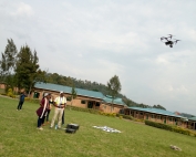
Joint UAV data acquisition with Rwanda Land Management and Use Authority
What: Joint UAV data acquisition with RLMUA Where: Musanze, Rwanda When: 5 February 2019 What: Joint UAV data acquisition in Musanze to implement the established MoU between Rwanda Land Management and Use Authority (RLMUA) and [...]

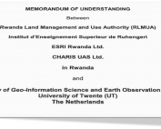
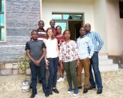
Extending our strategic collaborations in Rwanda
What: Extending our strategic collaborations in Rwanda Where: Kigali, Rwanda When: 19 December 2018 What: The Rwanda Land Management and Use Authority (RLMUA), Institut d’Enseignement Superieur de Ruhengeri, ESRI Rwanda Ltd., CHARIS UAS Ltd., and [...]
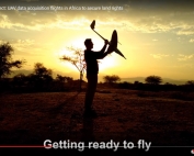
its4land video about UAV data acquisition flights in Africa to secure land rights online
What: 3min medley of UAV data acquisition flights in Africa Where: on the Fly and Create webpage When: 15 November 2018 Who: Claudia Stöcker, University of Twente/Faculty of Geo-information Science and Earth Observation (ITC), Netherlands [...]
QGIS plugin to support the interactive delineation of visible cadastral boundaries from UAV data available for download
What: New tool available to support the interactive delineation of visible (cadastral) boundaries in orthoimages Where: Free download When: November 2018 Who: Developed by Sophie Crommelinck, University of Twente/ITC, Netherlands Within the context of its4land, ITC's PhD [...]

NCG Symposium 2018
What: NCG symposium 2018 Where: Wageningen, Netherlands When: 29 November 2018 Who: Claudia Stöcker and Sophie Crommelinck, University of Twente/ITC, Netherlands Why: Presentations by both PhD students about their its4land work What can UAVs do in 10 [...]
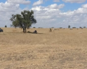
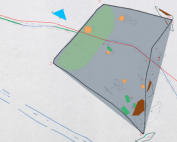
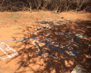
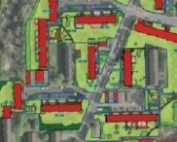
Fieldwork in Kajiado to test boundary delineation software
What: Fieldwork in Kajiado, Kenya When: 26-27 September 2018 Who: Sophie Crommelinck, University of Twente/Faculty of Geo-information Science and Earth Observation (ITC), Netherlands Purpose: To collect images, information and locations of cadastral boundaries and to get [...]
Special issue “Remote Sensing for Land Administration” – call for papers
Mila Koeva and Rohan Bennett as two of the guest editors are glad to invite you to submit papers that adress the following topics: Comparisons of alternate remote sensing techniques for 2D and 3D data [...]
its4land – Period 2 – European Commission Review
What: its4land – Period 2 – European Commission Review Where: Brussels, Belgium When: 16 October 2018 Who: EC Review Panel: F. Boissière, J. Santos with external reviewers K. Meuleman, D. Sladic and J. Kiema (not present), and the its4land team Why: A [...]
Review of governance and capacity development models for its4land tools
The second deliverable of its4land’s Govern and Grow work package ‘Review of governance and capacity development models’ aims to get a better interdisciplinary understanding of existing models of governance and capacity development. Based on a [...]
Interviews in Rwanda and Kenya to better understand the land tenure recording governance
What: Qualitative data collection in Rwanda and Kenya to understand the governance of the current land tenure recording situation and to find out how the its4land tools need to be used in a sustainable way. Where: [...]
Milestone in development of smart sketch maps system
Its4land researchers from the Institute for Geoinformatics at the University of Muenster submited three deliverables on 31st July this year. The three deliverables D3.3 qualitative representation of sketch maps; D3.4 documentation of extended LADM; and D3.5 prototype for sketch map alignment are [...]
Symposium on Feature Extraction for Cadastral Boundaries
What: Symposium on Feature Extraction for Cadastral Boundaries Where: University of Twente, Faculty of Geo-information Science and Earth Observation (ITC) When: 25 October 2018 Joined event between ITC and Kadastre International - exchange of experience in automatisation on [...]
Workshops for feedback on its4land’s Smart Skema system
What: Field work in Kenya to demonstrate the functionality of the Smart Skema system in order to receive feedback on how the system could be used in actual practice Where: Kajiado and Nairobi, Kenya When: 24 [...]
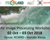
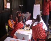
Capacity development – image processing workshop for its4land UAV pilots
What: Capacity development – image processing workshop for its4land UAV pilots Where: Regional Centre for Mapping of Ressources for Development (RCMRD), Nairobi, Kenya When: 2 and 3 October 2018 Who: Lead: University of Twente, Faculty of [...]
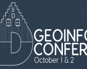
3D GeoInfo Conference
What: its4land's Mila Koeva organized together with TU Delft the 2018 3D GeoInfo Conference Where: Delft, Netherlands When: 1 and 2 October 2018 Who: Mila Koeva, University of Twente, Faculty of Geo-information Science and Earth Observation (ITC) Mila Koeva its4land [...]
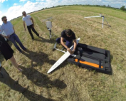
UAV test flights carried out for accuracy assessment
What: 18 UAV test flights in the Netherlands Where: Bentelo, Netherlands When: 13 July 2018 Who: ITC UAV pilots in collaboration with DroneExperts and Space53 Why: - 18 test flights were carried out with the [...]
software architecture to disseminate its4land tools ready
What: software architecture to disseminate its4land tools ready When: 31 July 2018 Who: Hansa Luftbild, Germany The “Publish and Share” work package (work package 6), led by Hansa Luftbild, has developed together with the other technical [...]
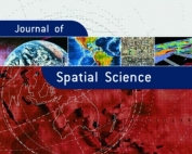
its4land’s Mila Koeva and Rohan Bennett awarded for best research and review paper
What: A procedure for semi-automated cadastral boundary feature extraction from high-resolution satellite imagery has been awarded the Best Research and Review Paper Award for 2018 by the Editorial Board of the Journal of Spatial Science. When: 11 July 2018 [...]

Social challenges of developing fit-for-purpose technologies for land tenure security in East Africa
What: New itsland article in RICS land journal When: April-May edition 2018 Who: Serene Ho, Ine Buntinx and Joep Crompvoets of KU Leuven (Belgium) Why: the its4land project is examining social challenges of developing fit-for-purpose [...]
its4land at LANDac
What: Chair a session and presentation at LANDac Annual Conference: LAND GOVERNANCE AND (IM)MOBILITY: Exploring the nexus between land acquisition, displacement and migration When: 28 June 2018 Where: Utrecht, The Netherlands Who: Claudia Stöcker (University of Twente, [...]
Urban Studies Symposium: People, Land and Urban Systems
What: Urban Studies Symposium: People, Land and Urban Systems Where: University of Twente/ITC, Enschede, Netherlands When: 13-14 June 2018 Who: Mila Koeva, Claudia Stöcker, Sophie Crommelinck Why: interactive poster sessions on its4land topics interactive workshop - Its4land - [...]
its4land at ISPRS TC II Symposium
What: ISPRS TC II Symposium ‘Towards Photogrammetry 2020’ When: 4-7 June 2018 Where: Riva del Garda, Italy Who: Sophie Crommelinck and Mila Koeva (University of Twente, ITC) Why: Sophie: to present her latest research paper on [...]
its4land at FIG 2018
What: Presentation at FIG When: for FIG conference, 6-11 May, 2018, Instanbul, Turkey Who: Claudia Stöcker and Mila Koeva (University of Twente, ITC) Why: Presentation and publication by Stöcker et al.: “Towards UAV-based Land Tenure Data [...]
Good governance and capacity building as an enabler for the its4land tools
What: Deliverable 7.1: “Governance and capacity development definition” ready When: 26 April, 2018 Who: KU Leuven Deliverable 7.1: “Define governance and capacity development in the context of its4land” Although technical innovations are crucial to overcome current [...]
Its4land runs Masterclass on Smart SkeMa system at World Bank conference
What: Land and Poverty Conference 2018: Land Governance in an Interconnected World Where: World Bank, Washington, DC, United States When: 19-23 March, 2018 Who: Malumbo Chipofya and Cristhian Murcia from Muenster University (WWU) Why: Its4land was at the 2018 [...]
Winterschool to improve skills for interviewing and interview data analysis
What: ECPR Winterschool in methods and techniques Where: Bamberg, Germany When: 2-9 March Who: Ine Buntinx (KU Leuven) Why: During the second week of March Ine was following a short course on qualitative data analyzing with Nvivo [...]
UAV data collection in Kenya
What: UAV data collection in Kenya - Kajiado Where: Mailua, Kajiado When: 7 - 8 March, 2018 Who: Technical University of Kenya (TUK), Hansa Luftbild Münster (HL), University of Twente (ITC) Why: After being patient [...]
EU support service for development of its4land business case
What: Common Exploitation Booster meeting Where: University of Twente/ITC, Enschede, Netherlands and via Skype When: 7 March, 2018 Who: the its4land team and Tunde Kallai, Senior EU expert Common Exploitation Booster Why: The European Commission offers support services for ongoing R&I projects across [...]
World Bank Land and Poverty Conference 2018
What: Land and Poverty Conference 2018: Land Governance in an Interconnected World Where: World Bank, Washington, DC, United States When: 19-23 March, 2018 Who: Serene Ho from KU Leuven and Malumbo Chipofya and colleagues from Muenster University (WWU) [...]
UAV flight permission breakthrough in Kenya
What: its4land obtained a special flight permission to conduct UAV flights in Kenya Where: Kajiado and Kisumu, Kenya When: 29 January, 2018 Who: Technical University of Kenya Why: The Kenya Civil Aviation Authority grants authorization [...]
UAV data collection in Zanzibar
What: UAV data collection in Zanzibar Where: Pemba and Unguja, Zanzibar When: 31 January - 8 February, 2018 Who: Claudia Stöcker (ITC) with support from WeRobotics Flying Labs Tanzania and Commission of Lands Zanzibar Why: [...]
Presentation at the Gender Peace and Security institute, Monash University (Australia)
Photo credit: Lesley Pruitt, Monash GPS What: Presentation at the Gender Peace and Security institute Where: Monash University (Australia) When: 21 February, 2018 Who: Serene Ho ICT4D: whose ‘I’, which ‘T’ and how to get to ‘D’? [...]
3rd Annual Land Conference by Bahir Dar University
What: 3rd Annual Land Conference - conference theme: Promoting an evidence-based Land Administration System in Ethiopia When: 15-16 May, 2018 Who: The Institute of Land Administration of Bahir Dar University Why: Call for abstract submission
Research visit GIScience Heidelberg University
What: Research visit GIScience Heidelberg University Where: Heidelberg, Germany When: September 2017 - January 2018 Who: Sophie Crommelinck, PhD at University of Twente/ITC for its4land project Why: To work on her PhD research with input from a [...]
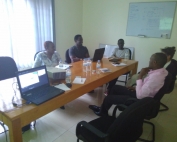
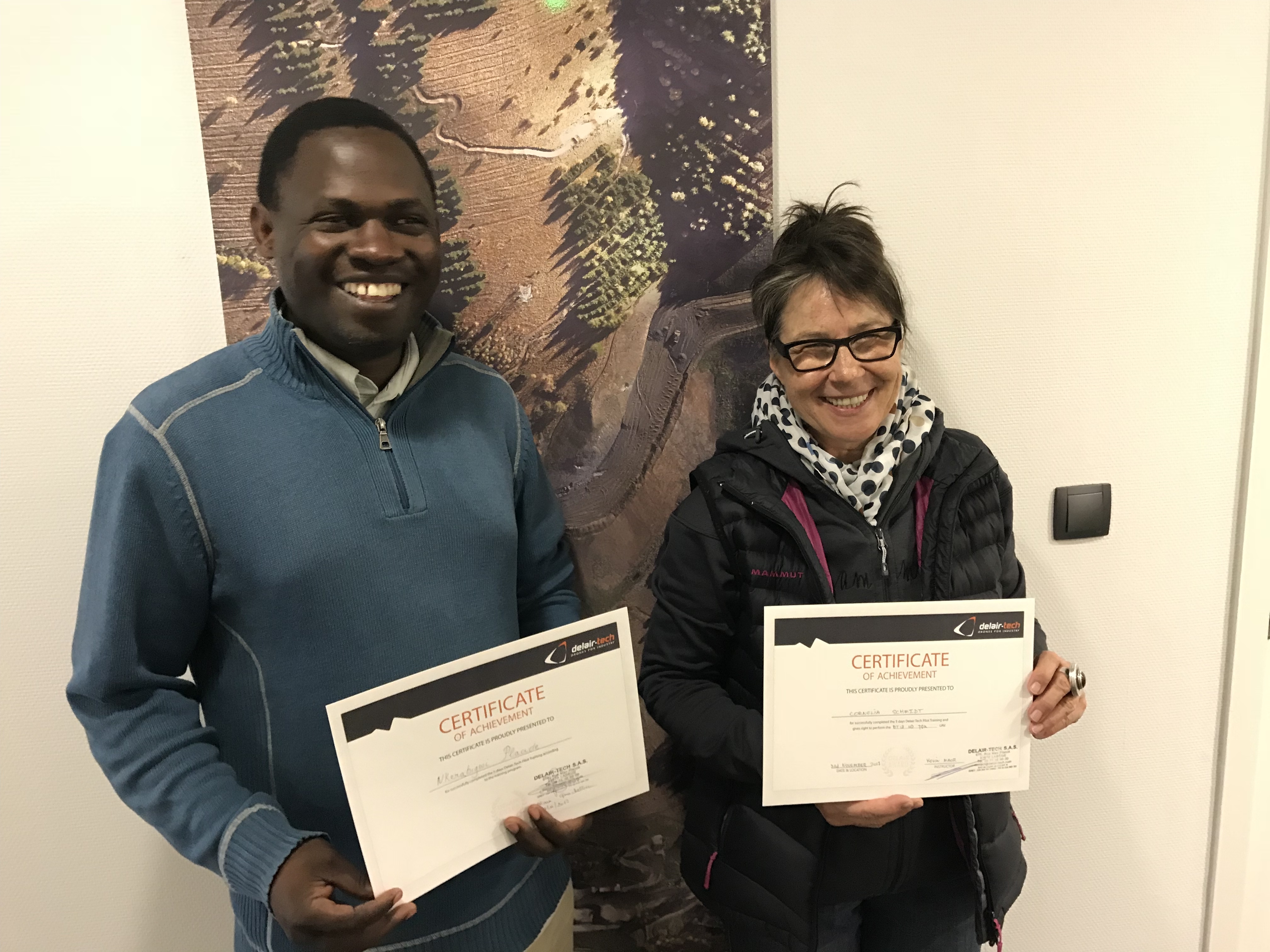
Meeting with Rwanda Valorization Panel
What: Meeting with the Rwanda Valorization panel Where: ESRI Rwanda office - Kigali, Rwanda When: 25 January 2018 Who: Kenny Kirotich (G.I.S. Tech), Annie Kairaba and two additional delegates (RISD), Cornelia Schmidt (ESRI Rwanda) and [...]
Expert opinion from its4land Advisory Board
What: its4land Advisory Board meeting Where: University of Twente/ITC, Enschede, Netherlands and via Skype When: 7 November, 2017 Who: Advisory Board members: Judy Kariuki (United Nations Economic Commission for Africa (UNECA)), Michael Nagenborg (University of Twente), Matt [...]
its4land presentation at GIZ
What: its4land presentation at GIZ (Gesellschaft für internationale Zusammenarbeit - German Agency for International Cooperation) Where: Eschborn, Germany When: 13 December, 2017 Who: Jaap Zevenbergen (University of Twente/ITC) Why: to deliver a key note at the second GIZ LandHub Meeting [...]
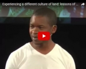
Malumbo Chipofya talks about how its4land focuses on local needs at TEDx Münster 2017
What: TEDx talk: experiencing a different culture of land: lessons of a technologist Where: TEDx Münster When: September 2017 Who: Malumbo Chipofya of University of Münster Why: University of Münster's Malumbo Chipofya highlighted why it is important for projects working on [...]
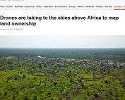
Drones are taking to the skies above Africa to map land ownership
What: an article in The Conversation Where: Kenya When: 26 November 2017 Who: Robert Wayumba, lecturer at the Technical University of Kenya and involved in the its4land project Why: Robert has written an article entitled: 'Drones are taking to the [...]
Its4land – first two pilots UK CAA certified
What: Fixed Wing Drone Trainings and UK Drone Pilot Flight Assessment Where: Toulouse, France; Chepstow, Wales, UK When: 13 - 17 November, 2017, Trainings in Toulouse; 20 - 21 November, 2017, Flight Assessment in Chepstow, [...]
Towards automated boundary delineation for UAV-based cadastral mapping
What: Poster presentation 'Towards automated boundary delineation for UAV-based cadastral mapping' Where: The ‘Fachaustausch Geoinformatik’ in Heidelberg When: 23 November 2017 Who: Sophie Crommelinck, University of Twente/ITC Why: To present the current state of her PhD work with a [...]
New its4land article on UAVs and land rights in Kenya presented at conference
What: new its4land article on UAVs and land rights in Kenya was presented at the 2017 Conference on Land Policy in Africa. Where: Addis Ababa, Ethiopia When: 14-17 November, 2017 Who: Robert Wayumba, University of Kenya and Peter Odwe [...]
its4land work feeds e-Agriculture webinar
What: webinar called ‘e-Agriculture online self-learning course: An introduction to the use of drones in agriculture’ organized by the Food and Agriculture Organization of the United Nations (FAO) and e-Agriculture Where: webinar, hence on the internet! When: 23 October [...]
Exploitation booster: bridging the gap between research and exploitation
What: an its4land meeting in preparation of the Common Exploitation Booster meeting on 7 March 2018 Where: University of Twente/ITC, Enschede, Netherlands When: 16 October 2017 Who: the its4land work package leaders. The meeting was led by Tarek Zein of [...]
Project coordination change at INES Rwanda
What: Project coordination change at INES Rwanda Where: Institut d’Enseignement Supérieur de Ruhengeri, Rwanda (INES) When: 16 October 2017 Who: Placide Nkerabigwi and Jossam Potel replace Mereille Biraro as new its4land contacts at INES Why: Mireille Biraro, its4land contact [...]
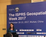
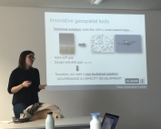
The ISPRS Geospatial week 2017
What: The ISPRS Geospatial Week 2017 Where: Wuhan, China When: 18 - 22 September, 2017 Who: Mila Koeva, University of Twente, Netherlands Why: Mila presented a paper at the ISPRS Geospatial Week 2017: "Towards innovative geospatial tools for fit-for-purpose land rights [...]
its4land work presented at UAV-g
What: UAV-g 2017 - International Conference on Unmanned Aerial Vehicles in Geomatics Where: Bonn, Germany When: 4 - 7 September, 2017 Who: Sophie Crommelinck and Claudia Stöcker, University of Twente, Netherlands Why: Scientific conference on Unmanned Aerial Vehicles (UAV) regarding recent developments [...]
Requirements synthesis of land tenure information needs ready
Over the last year, ‘Get Needs’ (work package 2), led by KU Leuven, has engaged with almost 60 organisations and community groups (around 100 individuals) across Rwanda, Kenya and Ethiopia and sought to identify relevant land [...]
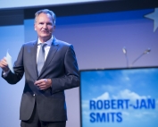
Meeting the European Commission DG Research & Innovation
What: a meeting between the University of Twente's H2020 coordinators and the Director-General for Research and Innovation of the European Commission, Mr. Robert-Jan Smits. Where: University of Twente/ITC, Enschede, Netherlands When: 4 September 2017 Who: Mila Koeva, representing the its4land [...]
Governance models to support the implementation of innovative tools
What: 2017 European Group for Public Administration (EGPA) Annual Conference - EGPA Symposium for doctoral students and junior researchers Where: Milan, Italy When: 30 August – 1 September, 2017 Who: Ine Buntinx, KU Leuven Public [...]
its4land reports from QGIS 2017
What: 18th QGIS User Conference and Developer Meeting Where: Nødebo, Denmark When: 2 - 11 August, 2017 Who: Sophie Crommelinck, University of Twente, Netherlands Why: To give a presentation about current state of Ph.D. work and the developed QGIS plugin [...]
Capturing end-user needs: lessons learned
The work package, ‘Get Needs’ (work package 2), led by KU Leuven, is the foundational phase of the its4land project. It is fundamentally about capturing the end-user and market opportunities regarding land tenure recordation tools [...]
From a hand drawn map to meaningful digital objects in a automated way: its4land delivers
On 31st July researchers from University of Münster, Germany, Bahir Dar University, Ethiopia, and the Technical University of Kenya, delivered two prototypical components of its4land's Smart Sketch Maps system. The delivered pieces are an important [...]
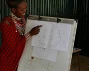
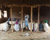
Rural communities in Kenya and Ethiopia sketching maps
The its4land team reports The University of Munster tag-team of Malumbo Chipofya and Sahib Jan went on a field work marathon in Kenya and Ethiopia from 21st June 2017 to 30th June 2017. From the duo's perspective [...]
Gaining valuable insight in Ethiopian information needs
At the end of June, Katholic University Leuven, in collaboration with local partner, the Institute of Land Administration at Bahir Dar University, conducted its data collection for the ‘Get Needs’ work package in Ethiopia. The [...]
Innsbruck Summer School of Alpine Research
What: Innsbruck Summer School of Alpine Research – Close Range Sensing Techniques in Alpine Terrain. Where: Obergurgl, Austria When: 16 - 22 July, 2017 Who: Sophie Crommelinck, University of Twente, Netherlands Why: International summer school on innovative practical [...]
Towards Automated Cadastral Boundary Delineation from UAV data
What: Towards Automated Cadastral Boundary Delineation from UAV data - a new its4land report. Where: directly download the report or visit the 'Automate It' section of the its4land website. When: July 2017 Who: Sophie Crommelinck, Michael Ying [...]
UAVs for Land Rights – A Guide to Regulatory Practice
What: Deliverable 4.1 of work package 4, 'Fly and Create', is ready: a Guide to Regulatory Practice Where: Here When: 29 June 2017 Who: Claudia Stöcker, Rohan Bennett, Francesco Nex, Markus Gerke, Connie Schmidt, Tarek Zein Why: In order [...]
LANDac conference with its4land presentations
What: LANDac conference - Land Governance for Equitable and Sustainable Development Where: Utrecht, Netherlands When: 29 - 30 June, 2017 Who: Sophie Crommelinck and Mila Koeva, University of Twente, Netherlands Why: Scientific conference of land-related researches and activists with a focus on [...]
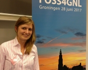
FOSS4GNL – its4land reports
What: FOSS4GNL Where: Groningen, Netherlands When: 28 June, 2017 Who: Sophie Crommelinck, University of Twente, Netherlands Why: Get-together of Dutch developers, users, and managers of open-access geographic information systems (GIS) such as QGIS. The objective was to network with people working [...]
Getting up-to-date on drones regulations and legislation at Drones East Africa Conference 2017
What: Drones East Africa Conference 2017 Where: Nairobi, Kenya When: 20 - 21 June, 2017 Who: Connie Schmidt, Esri, Rwanda Why: Connie Schmidt of Esri, Rwanda, partner in the its4land project, attended the conference to get up-to-date on [...]
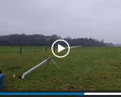
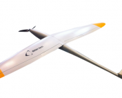
Video footage of maiden flight DT-18 UAV
What: Video footage of the first data capture with the DT-18 by the University of Twente team Where: Aamsveen, Germany When: January 20 2017 Who: Claudia Stocker and Watse Siderius (UT) Why: Back in January, we spent a news [...]
ISPRS Workshop: sharing experiences on automated feature extraction from high resolution imagery
What: ISPRS Workshop Where: Hannover, Germany When: 6 - 9 June, 2017 Who: Sophie Crommelinck, University of Twente/ITC, Netherlands Why: To attend the workshop to share the progress on work package 5: 'Automate It', which aims to exploit the imagery [...]
Report back from IST-Africa 2017 Conference
What: IST-Africa 2017 Conference Where: Windhoek, Namibia When: 31 May-2 June 2017 Who: John Horn, University of Twente/ITC, Netherlands Why: The 2017 IST Africa conference was held in Windhoek, Namibia over the period 31st May to 2nd June. Within [...]
New QGIS plugin for detecting field boundaries tested during its4land workshop
What: its4land organised a workshop to test its newly developed QGIS plugin capable of delineating field boundaries Where: University of Twente/ITC, Enschede, Netherlands When: Tuesday 23 May 2017 Who: 14 volunteers Why: 14 volunteers, all MSc or PhD students from [...]
WP3–Field visit to Bahir Dar, Ethiopia
Sahib Jan and Malumbo Chipofya from Institute for Geoinformatics, University of Münster teamed together with Berhanu Kefale Alemie of Institute of Land Administration (ILA) Bahir Dar University for a week of information dissemination, networking, and [...]
Review of the current state of UAV regulations
What: a new publication from the its4land project on the current state of UAV regulations around the world. Where: Remote Sens. 2017, 9, 459; http://www.mdpi.com/2072-4292/9/5/459 When: May 2017 Who: Claudia Stöcker, Rohan Bennett, Markus Gerke, Francesco Nex, Jaap Zevenbergen. Why: UAVs—unmanned aerial [...]
its4land – Period 1 – European Commission Review
What: its4land – Period 1 – European Commission Review Where: Leuven, Belgium When: 21st April 2017 Who: EC Review Panel, Georges Lobo, its4land MT (and special guests) Why: A one day review corresponding to the first reporting period took place [...]
Report on 2017 World Bank Conference on Land and Poverty
What: Annual World Bank Conference on Land and Poverty Where: Washington D.C., United States When: 19-21 March 2017 Who: Tarek Zein (Hansa Luftbild, Germany), Rohan Bennett, Mila Koeva, Jaap Zevenbergen (University of Twente/ITC, Netherlands), Joep Crompvoets, Serene Ho (University of [...]
its4land present at the 6th Land Administration Domain Model (LADM) Workshop
What: The 6th Land Administration Domain Model (LADM) Workshop Where: Technical University in Delft, The Netherlands When: 16-17 March 2017 Who: Mila Koeva, Carline Amsing Why: two presentations on its4land were held during the LADM workshop: ‘Remote sensing [...]
Welcome Mila Koeva!
What: Mila Koeva joins its4land team as New Project Coordinator Where: Enschede, Netherlands When: 31 March 2017 Who: Mila Koeva & Rohan Bennett Why: From March 2017, Dr. Mila Koeva is joining the its4land team as the new Project Coordinator. [...]
WP5 – Automate It – 2 New Publications!
What: WP5 Dissemination - Publications x 2* Where: Remote Sens. 2016, 8(8), 689; doi:10.3390/rs8080689 + Remote Sens. 2017, 9(2), 171; doi:10.3390/rs9020171 When: August 2016 and February 2017 Who: Sophie Crommelinck, Rohan Bennett, Markus Gerke, Francesco Nex, Michael Ying Yang and George Vosselman Why: The first [...]
Meeting – its4land 2017 Plenary
What: its4land 2017 Plenary Where: Leuven, Belgium When: 8th March 2016 Who: Everyone! 🙂 Why: Look back on 2016, discuss and debate the current state-of-play, and case forward to 2017
WP4 – UAV comparisons and GCP tests
What: The UT WP4 team flew the area around the monastery Gerleve together with Dirk Ohnsorge - the pilot from HansaLuftbild. The weather was perfect – sunny and no wind. The area is a bit undulated [...]
Recent Comments