
 We’ve created six new tools to make land rights mapping faster, cheaper, easier, and more responsible
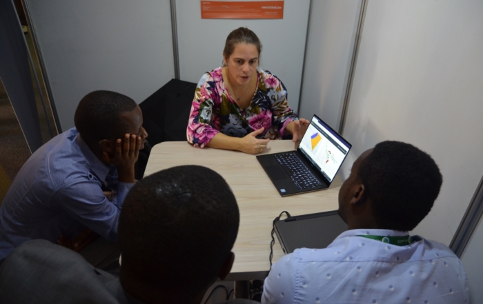
Needs assessment
A tool for sharing, understanding and visualising what users really needDetermine the requirements of diverse stakeholder groups
Read moreSmartSkeMa
A tool that converts hand drawn sketches into computer-ready boundary mapsUse hand drawn sketches to make land tenure mapping more friendly
Read moreUAV workflows-Orthophoto Generator
A boutique imagery creation tool tailored for land rights mapping - anywhere, anytimeEmbed unmanned aerial vehicles into your land tenure mapping processes
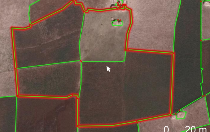
Read moreVisible Boundary Delineator
A tool that discovers visible boundaries hidden in imagery, and converts them to usable land rights informationLet intelligent software identify potential land tenure boundaries
Read morePublish and Share Platform for Land Administration Workflows
A tool for simplifying land rights information processing, storage, and visualizationA robust cloud-based land tenure storage solution
Read moreGovernance and capacity building
A governance and capacity development tool aimed at making land rights mapping sustainableEnsure land tenure mapping solutions are embedded responsibly, and are here for the long haul
Read moreLatest news

In the media
More its4land
Partners

Recent Comments