
Early this year, the SmartSkeMa team at IfGI (University of Muenster) introduced an update on their web-based user interface (UI) to the SmartSkeMa system (see Figure 1). This interface integrates all the components of SmartSkeMa. Currently, we are still working on improvements to the UI, taking into account suggestions from partners within and outside the its4land consortium. The new SmartSkeMa interface comes with a host of new features including (but not only):
- SVG editor: the svg editor introduces in-app image editing. This allows the user to improve features detected in the object recognition step by drawing new features, editing the geometry of existing features and deleting wrongly detected features from the sketch maps.
- Adding land tenure information: all geometries in the vector representation of the sketch map can now be annotated with land tenure attributes in a click. So users can now quickly add more information about the features such as rights, restrictions, and responsibilities (RRR) associated with them. Moreover these features are added using local terminology and semantics. SmartSkeMa then internally translates the locally expressed land tenure records into LADM terms so that they can be fed to a standard LAS or at least be evaluated in the context of standard administration systems.
- Retrieving non-spatial data: apart from adding them, the interface also allows users to view non-spatial information about drawn features in the sketch map. On selection of a feature in the sketch map the system will display the rights (ownership, general usage rights, etc.) attached to that feature.
- Retrieving spatial data: users can also inspect the qualitative spatial information derived from the input map and use that information to retrieve specific data from the system. For example, a user might want to know where a feature drawn in the sketch map but not included in the existing base map data is approximately located in reality. Here a user can toggle the different spatial relations that the feature of interest participates in and see the regions in the base map to which they correspond.
- Handling sketches drawn atop aerial images: SmartSkeMa now supports processing of maps sketched on top of aerial images (see Figure 2). The vectorization steps (object detection, classification, editing, etc.), remain the same. The difference is that special ground reference points must be marked in the sketch and used to georeference the sketch map.
This is a sample of some of the major improvements to SmartSkeMa but is by no means an exhaustive list of its features. Keep an eye on this space to be updated about planned and new features as we release them. Also, you’ll be the first to know when SmartSkeMa is made available to the public for testing.
The live demo videos are available on the following link: www.smartskema.eu
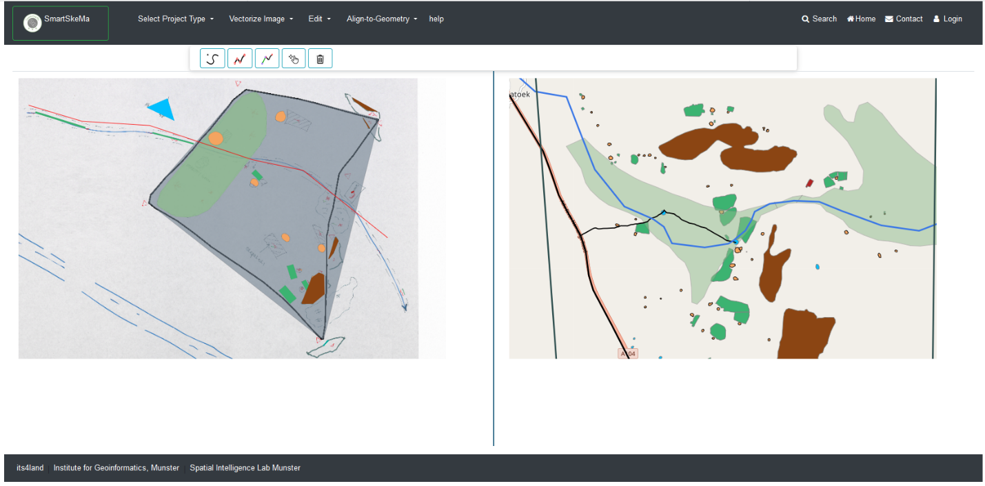
Figure 1: Web-based user interface of the SmartSkeMa tool for processing freehand sketch maps
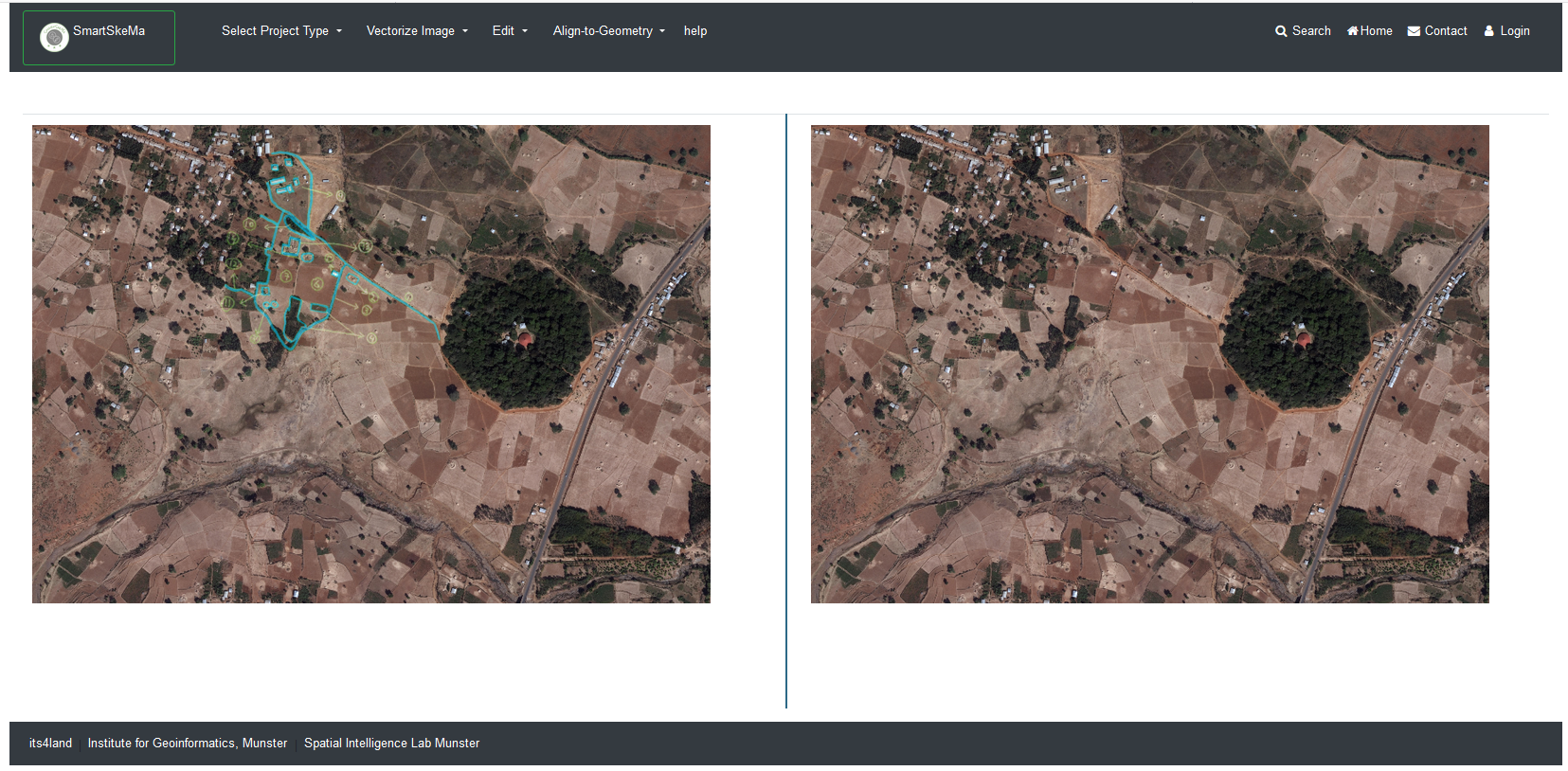
Figure 2: SmartSkeMa interface for processing drawing on top of orthophoto
Recent Comments