Sahib Jan and Malumbo Chipofya from Institute for Geoinformatics, University of Münster teamed together with Berhanu Kefale Alemie of Institute of Land Administration (ILA) Bahir Dar University for a week of information dissemination, networking, and field work planning.
The trio kicked their work week off with activities at the 2nd Ethiopian Annual Conference on Land Administration in Bahir Dar. Berhanu, who also chaired the conference organization team, gave talk on the its4land project, highlighting its goals and progress so far. Berhanu’s talk was received much interest and sparked debate over regulations on UAV flights and security concerns. Malumbo and Sahib also caught up with some of the conference participants to discuss its4land related issues. This included brief discussions about how smart sketch maps work and where they could be applied in the land registration programmes in Ethiopia.
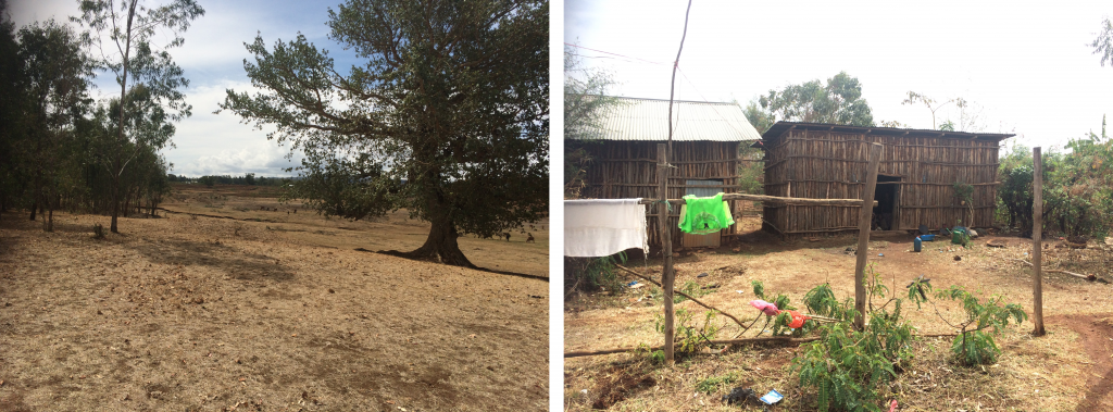
After the conference and a number of planning meetings, the trio headed off to the field where Berhanu gave the team a tour of three potential sites at which its4land could perform data collection: Yibab Rural Kebele just outside of Bahir Dar University, Wuramit Kebele across the landscape north of the University, and Robit Bata Rural Kebele about 20 kilometers outside Bahir Dar city. The data to be collected include data for needs identification, work package 2, development and testing of the smart sketch maps system, work package 3, UAV flight planning, work package 4, and development and testing of the feature extraction tool, work package 5.

(a) Land parcels and houses in Yibab Rural Kebele just outside of Bahir Dar University ,(b) demolished moonhouse by Kebele authorities.
The guests, Malumbo and Sahib, appreciated the warm welcome they received in Bahir Dar. They are looking forward to getting back and doing work there!


Recent Comments