Recent Tweets

Recent Comments

/News/

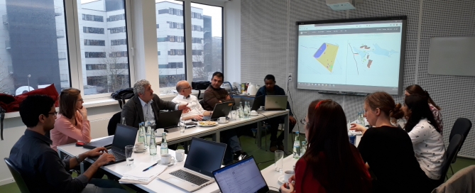
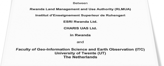
Meeting – its4land MT25

What: its4land MT25 Where: Online (participants from Netherlands, Belgium, Germany, Rwanda, Kenya and Ethiopia) When: Thursday 31 January 2019 (14:00 – 16:00 CET) Who: its4land MT members Why: The MT meets on a regular basis, particularly with regards to milestone accountability and deliverables.

By | March 28th, 2019|Meetings|0 Comments

Sketch mapping still smarter with new interface

Early this year, the SmartSkeMa team at IfGI (University of Muenster) introduced an update on their web-based user interface (UI) to the SmartSkeMa system (see Figure 1). This interface integrates all the components of SmartSkeMa. Currently, we are still working on improvements to the UI, taking into account suggestions from partners within and outside the [...]

By | March 26th, 2019|News|0 Comments

Capacity building in Rwanda – UAV image processing workshop for RLMUA

Where: Kigali, Rwanda When: 13 February 2019 What: As agreed between Rwanda Land Management and Use Authority (RLMUA) and the University of Twente, Faculty of Geo-information Science and Earth Observation (ITC), one part of the Memorandum Of Understanding also foresees capacity building. After the successful data acquisition mission in Musanze, seven representatives of RLMUA were [...]

By | March 5th, 2019|News|0 Comments

Participatory mapping of cadastral boundaries in Rwanda

What: Participatory mapping of cadastral boundaries in Rwanda through the use of UAV captured orthopotos Where: Musanze, Rwanda When: 11 February 2019 its4land researcher Claudia Stöcker investigated the opportunities to use UAV datasets for participatory mapping of cadastral boundaries in Musanze, Rwanda. More than 30 households participated in this activity. The high level of detail of [...]

By | February 11th, 2019|News|0 Comments

Joint UAV data acquisition with Rwanda Land Management and Use Authority

What: Joint UAV data acquisition with RLMUA Where: Musanze, Rwanda When: 5 February 2019 What: Joint UAV data acquisition in Musanze to implement the established MoU between Rwanda Land Management and Use Authority (RLMUA) and Esri Rwanda, Charis UAS, INES Ruhengeri, and University of Twente, Faculty of Geo-information Science and Earth Observation (ITC). During our [...]

By | February 5th, 2019|News|0 Comments

Meeting – Tech4land 9.0

What: Tech4land meeting 9.0 Where: WWU, Munster, Germany When: 16 January 2019 Who: Malumbo Chipofya, Sahib Jan, Angela Schwering (WWU), Christian Timm, Tarek Zein, Imad (HL), Claudia Stocker, Sophie Crommelinck, Mila Koeva and Chiel Stroeven (ITC) Why: As part of a regular meeting pattern, we’re getting together to discuss the recent developments in each work package and interactions and interfaces between [...]

By | January 22nd, 2019|Meetings|0 Comments

G-STIC 2018

What: G-STIC conference Where: Brussels, Belgium When: 28-30 December 2018 Who: Ine Buntinx, KU Leuven, Belgium Why: The GSTIC conference will bring together key stakeholders from Science, Technology and Innovation communities (including the private sector) in order to catalyse change, strengthen the means of implementation and revitalise the global partnership for achieving the Sustainable Development Goals. [...]

By | December 20th, 2018|Events, Previous Events|0 Comments

The its4land team wishes you happy holidays

By | December 20th, 2018|News|0 Comments

Extending our strategic collaborations in Rwanda

What: Extending our strategic collaborations in Rwanda Where: Kigali, Rwanda When: 19 December 2018 What: The Rwanda Land Management and Use Authority (RLMUA), Institut d’Enseignement Superieur de Ruhengeri, ESRI Rwanda Ltd., CHARIS UAS Ltd., and Faculty of Geo-Information Science and Earth Observation (ITC) of the University of Twente (UT) signed a Memorandum of Understanding (MoU) [...]

By | December 19th, 2018|News|0 Comments

its4land video about UAV data acquisition flights in Africa to secure land rights online

What: 3min medley of UAV data acquisition flights in Africa Where: on the Fly and Create webpage When: 15 November 2018 Who: Claudia Stöcker, University of Twente/Faculty of Geo-information Science and Earth Observation (ITC), Netherlands Why: More than 20 different UAV data collection flights in East Africa shaped the work of WP4 during the last [...]

By | December 15th, 2018|News|0 Comments