
What: Land and Poverty Conference 2018: Land Governance in an Interconnected World
Where: World Bank, Washington, DC, United States
When: 19-23 March, 2018
Who: Serene Ho from KU Leuven and Malumbo Chipofya and colleagues from Muenster University (WWU)
What: The its4land team is once again looking forward to being present at, and participating in, the annual World Bank Land and Poverty Conference, to be held from 19-23 March 2018 in Washington DC. The team has been successful in their submissions which relate to the research undertaken as part of its4land project Work Package 2, ‘Get Needs’, and Work Package 3, ‘Draw and Make’. Serene Ho from KU Leuven will present a paper titled, “Co-production and co-creation of responsible land administration: insights into potential prospects and pitfalls from the ‘its4land’ project”, while Malumbo Chipofya from Muenster University will give a Master Class on Smart Sketch Maps, a software solution to support community mapping using sketch maps. The title of the Master class is “Smart Sketch Maps: A Tool for Community-driven Land Documentation using Hand Drawn Maps”. Colleagues from WWU will also present a a poster titled, “Modelling Local Knowledge for Inclusive and Responsive Land Information Systems: The Southern Kenyan Maasai Ontology”.
Abbreviated abstracts of the submissions are provided below with full proceedings to become available on the World Bank website once the conference is concluded.
————–
“Co-production and co-creation of responsible land administration: insights into potential prospects and pitfalls from the ‘its4land’ project.”
Authors: Serene Ho, Joep Crompvoets and Trui Steen (KU Leuven, Belgium)
This paper applies the concepts of co-production and co-creation from public administration to consider to what extent third generation land tools, like its4land tools, deliver, on the promise of responsible land administration by supporting participatory and inclusive use of new technologies in land tenure recording. Empirical data derived from fieldwork in East Africa is used to build an argument that, although the co-productive proposition of third generation land tools is reinforced, what this actually means is not entirely clear, and how this leads to value creation even less so. It appears that the structure of co-production is being technologically driven rather than needs driven and risks becoming a consequence of imitation, or worse, coercion, reinforcing old biases in new ways. In turn, this threatens the very value of responsibility that these tools propose to deliver.
“Smart Sketch Maps: A Tool for Community-driven Land Documentation using Hand Drawn Maps.”
Authors: Malumbo Chipofya1, Cristhian Murcia1, Mina Karamesouti1, Sahib Jan1, Angela Schwering1, Carl Schultz2
1University of Münster (Germany); 2Aarhus University (Denmark)
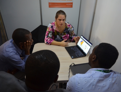
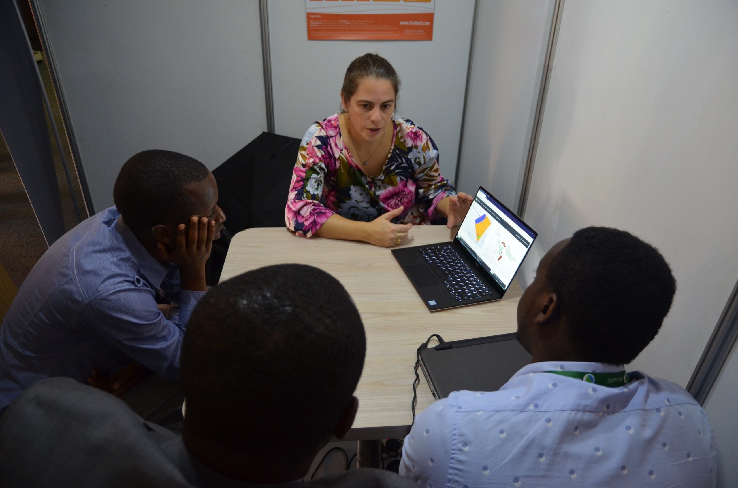
This Masterclass presents new tools designed to support bottom-up land tenure, land rights, and land resource mapping using hand drawn maps. These tools which form part of a system called Smart Sketch Maps, SmartSkeMa (pronounced smärt skē-mə) in short, facilitate automatic and semi-automatic interpretation of free-hand sketches (Chipofya et al., 2017). This fills a gap in the community mapping workflow which was traditionally solved through manual digitization (Knight et al., 2010). SmartSkeMa is not only concerned with digitizing objects drawn in the sketch map, it is designed to allow meaningful interpretation of these objects and geo-localization using existing map data of the area depicted in the sketch map. The goal of the Master Class is to demonstrate how the power of sketch maps in capturing relevant information from a community’s perspective can be harnessed using SmartSkeMa.
“Modelling Local Knowledge for Inclusive and Responsive Land Information Systems: The Maasai of Southern Kenya Ontology.”
Authors: Malumbo Chipofya1, Mina Karamesouti1, Sahib Jan1, Angela Schwering1, Cristhian Murcia1, Carl Schultz2, Serene Ho3, George Osewe4, Beatrice Chika4
1University of Münster (Germany); 2Aarhus University (Denmark); 3KU Leuven (Belgium); 4Technical University of Kenya (Kenya)
This poster presents a formal domain model for land-related concepts in Maasai communities in Kajiado County in Southern Kenya. The goal of the domain model, termed the Maasai of Southern Kenya Ontology (MSKO), is to contribute to closing the gap between the formal and indigenous or local conceptualizations of land tenure. MSKO supports a bottom-up approach to recording land tenure information that emphasizes local needs. MSKO is part of the innovative land tenure recording tool called “Smart Sketch Maps” (SmarSkeMa) that integrates information from hand drawn sketch maps into an underlying topographic base map. In this work we discuss the approach used in developing the MSKO domain model and provide empirical justifications for it.
Interested?
The team looks forward to presenting their research and engaging with interested stakeholders.
You can attend this Master Class by joining the 2018 World Bank conference. For more information, please visit the conference website:


Recent Comments