Latest Tech News
New QGIS plugin for detecting field boundaries tested during its4land workshop
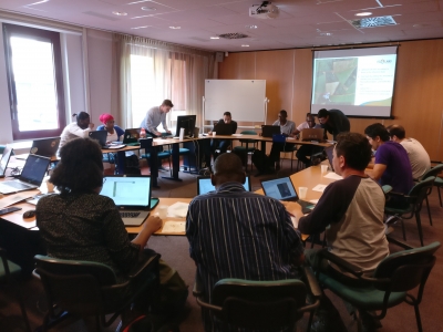
What: its4land organised a workshop to test its newly developed QGIS plugin capable of delineating field boundaries Where: University of Twente/ITC, Enschede, Netherlands When: Tuesday 23 May 2017 Who: 14 volunteers Why: 14 volunteers, all MSc or PhD students from ITC, were asked to delineate visible land parcel boundaries once manually and once with the help of a newly developed [...]
WP3–Field visit to Bahir Dar, Ethiopia
Sahib Jan and Malumbo Chipofya from Institute for Geoinformatics, University of Münster teamed together with Berhanu Kefale Alemie of Institute of Land Administration (ILA) Bahir Dar University for a week of information dissemination, networking, and field work planning. The trio kicked their work week off with activities at the 2nd Ethiopian Annual Conference on Land [...]
Review of the current state of UAV regulations
What: a new publication from the its4land project on the current state of UAV regulations around the world. Where: Remote Sens. 2017, 9, 459; http://www.mdpi.com/2072-4292/9/5/459 When: May 2017 Who: Claudia Stöcker, Rohan Bennett, Markus Gerke, Francesco Nex, Jaap Zevenbergen. Why: UAVs—unmanned aerial vehicles—facilitate data acquisition at temporal and spatial scales that still remain unachievable for traditional remote sensing platforms. However, current legal [...]
its4land – Period 1 – European Commission Review
What: its4land – Period 1 – European Commission Review Where: Leuven, Belgium When: 21st April 2017 Who: EC Review Panel, Georges Lobo, its4land MT (and special guests) Why: A one day review corresponding to the first reporting period took place on Friday, April 21th, 2017, at The Leuven Institute for Ireland in Europe, in Leuven. During this workday the first [...]
Report on 2017 World Bank Conference on Land and Poverty
What: Annual World Bank Conference on Land and Poverty Where: Washington D.C., United States When: 19-21 March 2017 Who: Tarek Zein (Hansa Luftbild, Germany), Rohan Bennett, Mila Koeva, Jaap Zevenbergen (University of Twente/ITC, Netherlands), Joep Crompvoets, Serene Ho (University of Leuven, Belgium) Why: to present three papers ITC co-authored, to chair two sessions, to host a Master Class on its4land and [...]
its4land present at the 6th Land Administration Domain Model (LADM) Workshop
What: The 6th Land Administration Domain Model (LADM) Workshop Where: Technical University in Delft, The Netherlands When: 16-17 March 2017 Who: Mila Koeva, Carline Amsing Why: two presentations on its4land were held during the LADM workshop: ‘Remote sensing data for boundary extraction’ by Mila Koeva, and ‘Linking new survey data acquisition methods and maintanance’ by Carline Amsing. For [...]
Welcome Mila Koeva!
What: Mila Koeva joins its4land team as New Project Coordinator Where: Enschede, Netherlands When: 31 March 2017 Who: Mila Koeva & Rohan Bennett Why: From March 2017, Dr. Mila Koeva is joining the its4land team as the new Project Coordinator. Mila is a quickly emerging Assistant Professor at the University of Twente, ITC Faculty - and she'll also play a [...]
WP5 – Automate It – 2 New Publications!
What: WP5 Dissemination - Publications x 2* Where: Remote Sens. 2016, 8(8), 689; doi:10.3390/rs8080689 + Remote Sens. 2017, 9(2), 171; doi:10.3390/rs9020171 When: August 2016 and February 2017 Who: Sophie Crommelinck, Rohan Bennett, Markus Gerke, Francesco Nex, Michael Ying Yang and George Vosselman Why: The first paper reviews the available tools for extracting boundary features from UAV imagery, the 2nd delivers the results of the application [...]
Meeting – its4land 2017 Plenary
What: its4land 2017 Plenary Where: Leuven, Belgium When: 8th March 2016 Who: Everyone! :) Why: Look back on 2016, discuss and debate the current state-of-play, and case forward to 2017
WP4 – UAV comparisons and GCP tests
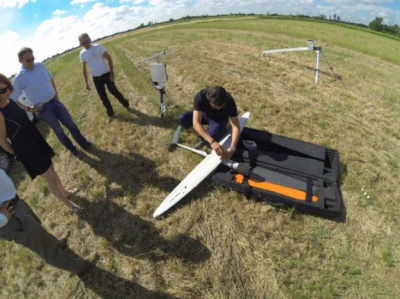
What: The UT WP4 team flew the area around the monastery Gerleve together with Dirk Ohnsorge - the pilot from HansaLuftbild. The weather was perfect – sunny and no wind. The area is a bit undulated – so a really nice test site to assess the geometric accuracy of the results. The team completed 2 flights with [...]




Recent Comments