
Latest Tech News

Geospatial World Forum
What: Geospatial World Forum 2019 Geospatial World Forum is a collaborative and interactive platform, which demonstrates collective and shared vision of the global geospatial community. It is an annual gathering of geospatial professionals and leaders representing the entire geospatial ecosystem Where: Teats art and event park, Amsterdam, Netherlands When: 3 April 2019 Who: Sophie Crommelinck, [...]
World Bank conference 2019
What: Land and Poverty Conference 2019: Catalyzing Innovation Where: Washington DC, United States When: 25-29 March 2019 Who: its4land gave a 90-minutes masterclass on Friday 29 March as well as three presentations. Output: Find below the programme of the its4land masterclass that we conducted, the presentations that were given and the videos that were shown. The programme of the [...]
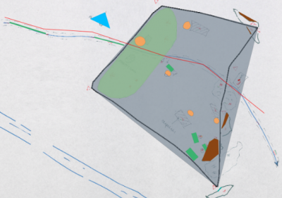
Sketch mapping still smarter with new interface
Early this year, the SmartSkeMa team at IfGI (University of Muenster) introduced an update on their web-based user interface (UI) to the SmartSkeMa system (see Figure 1). This interface integrates all the components of SmartSkeMa. Currently, we are still working on improvements to the UI, taking into account suggestions from partners within and outside the [...]
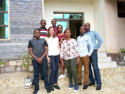
Capacity building in Rwanda – UAV image processing workshop for RLMUA
Where: Kigali, Rwanda When: 13 February 2019 What: As agreed between Rwanda Land Management and Use Authority (RLMUA) and the University of Twente, Faculty of Geo-information Science and Earth Observation (ITC), one part of the Memorandum Of Understanding also foresees capacity building. After the successful data acquisition mission in Musanze, seven representatives of RLMUA were [...]
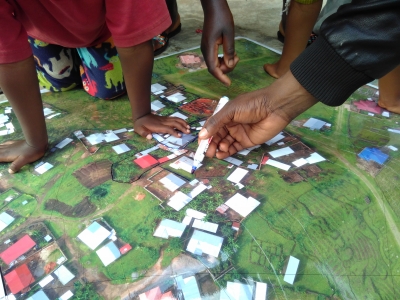
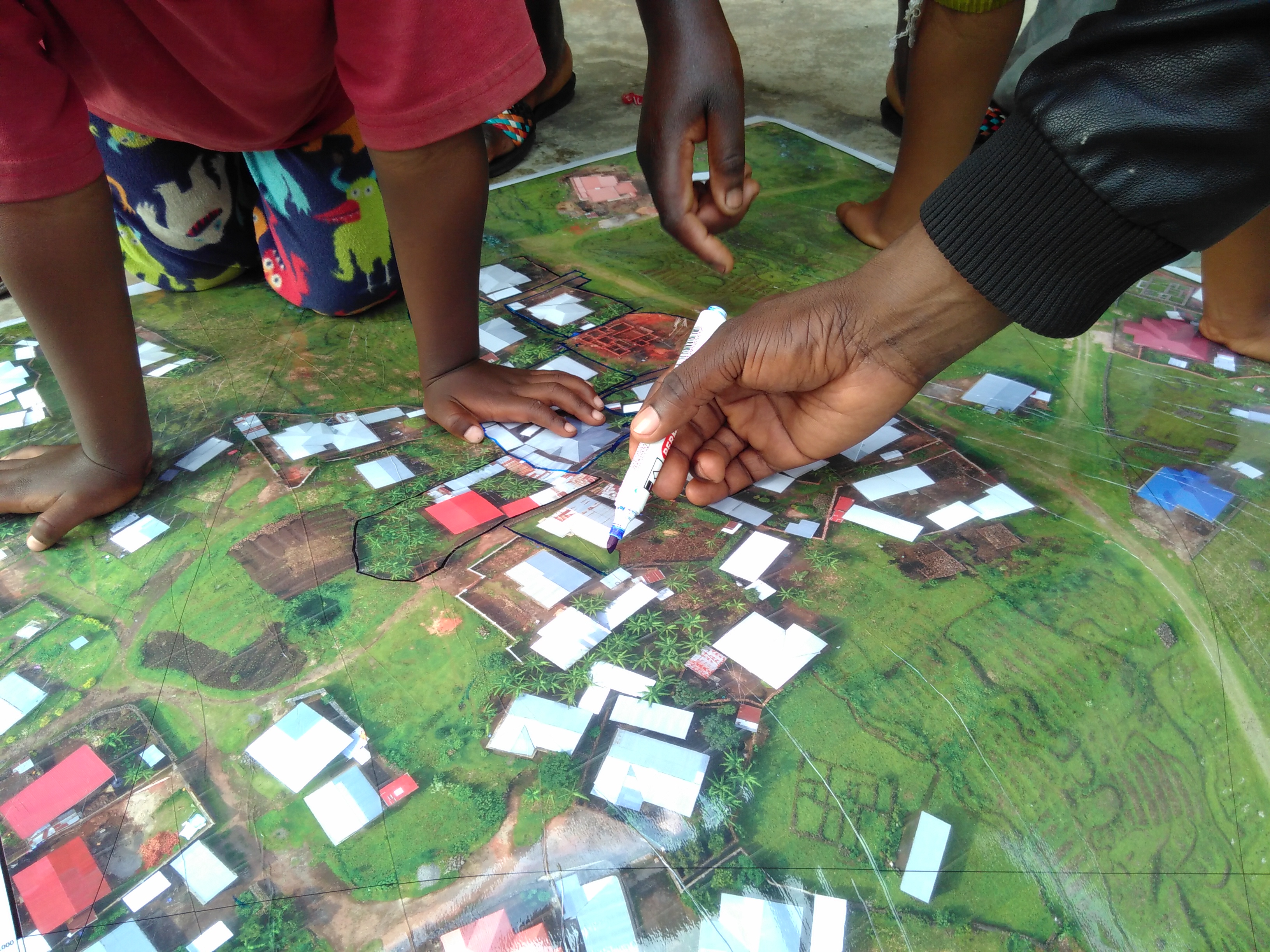
Participatory mapping of cadastral boundaries in Rwanda
What: Participatory mapping of cadastral boundaries in Rwanda through the use of UAV captured orthopotos Where: Musanze, Rwanda When: 11 February 2019 its4land researcher Claudia Stöcker investigated the opportunities to use UAV datasets for participatory mapping of cadastral boundaries in Musanze, Rwanda. More than 30 households participated in this activity. The high level of detail of [...]

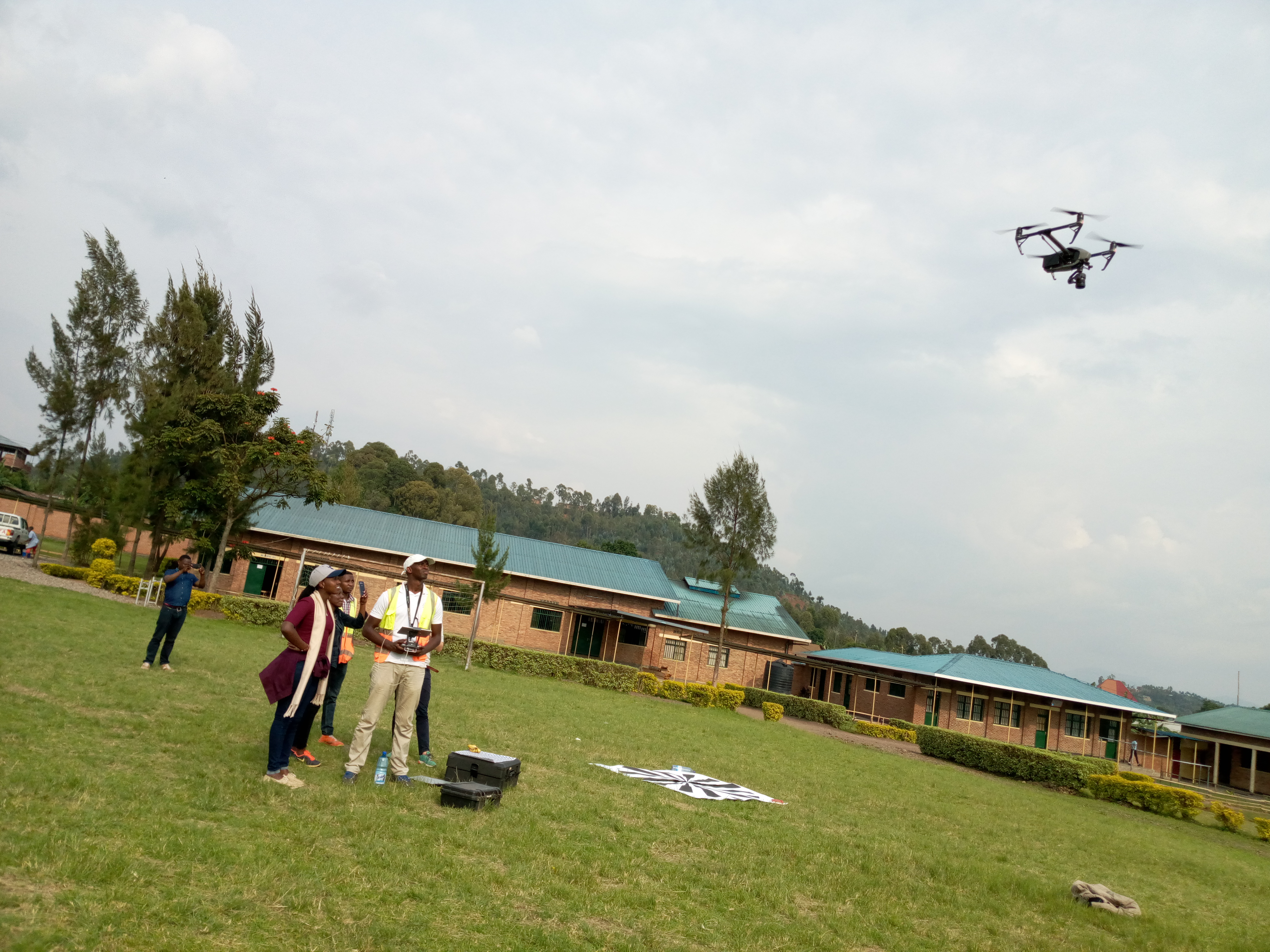
Joint UAV data acquisition with Rwanda Land Management and Use Authority
What: Joint UAV data acquisition with RLMUA Where: Musanze, Rwanda When: 5 February 2019 What: Joint UAV data acquisition in Musanze to implement the established MoU between Rwanda Land Management and Use Authority (RLMUA) and Esri Rwanda, Charis UAS, INES Ruhengeri, and University of Twente, Faculty of Geo-information Science and Earth Observation (ITC). During our [...]


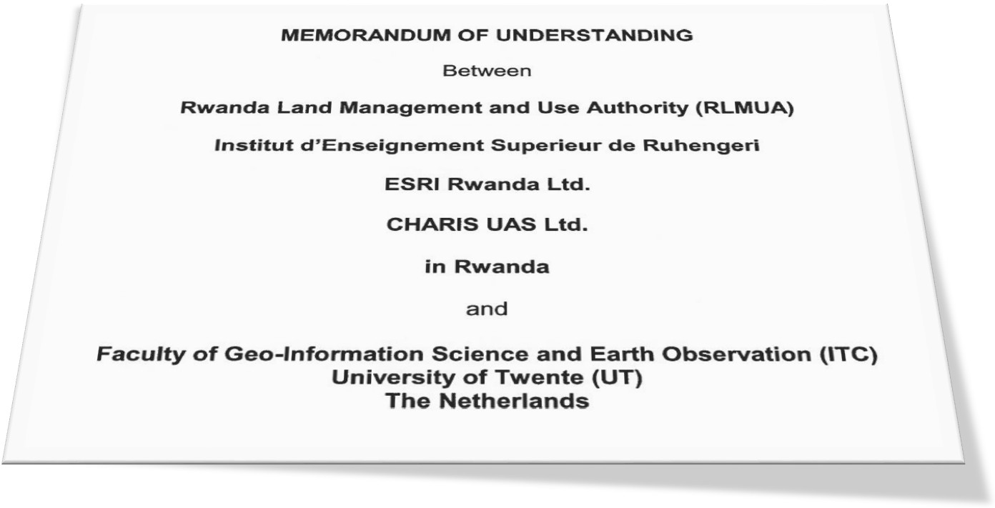
Extending our strategic collaborations in Rwanda
What: Extending our strategic collaborations in Rwanda Where: Kigali, Rwanda When: 19 December 2018 What: The Rwanda Land Management and Use Authority (RLMUA), Institut d’Enseignement Superieur de Ruhengeri, ESRI Rwanda Ltd., CHARIS UAS Ltd., and Faculty of Geo-Information Science and Earth Observation (ITC) of the University of Twente (UT) signed a Memorandum of Understanding (MoU) [...]
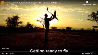
its4land video about UAV data acquisition flights in Africa to secure land rights online
What: 3min medley of UAV data acquisition flights in Africa Where: on the Fly and Create webpage When: 15 November 2018 Who: Claudia Stöcker, University of Twente/Faculty of Geo-information Science and Earth Observation (ITC), Netherlands Why: More than 20 different UAV data collection flights in East Africa shaped the work of WP4 during the last [...]
QGIS plugin to support the interactive delineation of visible cadastral boundaries from UAV data available for download
What: New tool available to support the interactive delineation of visible (cadastral) boundaries in orthoimages Where: Free download When: November 2018 Who: Developed by Sophie Crommelinck, University of Twente/ITC, Netherlands Within the context of its4land, ITC's PhD Sophie Crommelinck designed and developed a QGIS plugin to support the interactive delineation of visible (cadastral) boundaries from UAV data. The tool’s [...]
Recent Comments